Applied Anthropology Laboratory and consulting
Applied Anthropology Laboratory and consulting
"Empowering Community Engagement and Insight through Participatory Mapping of Social and Territorial Dynamics"
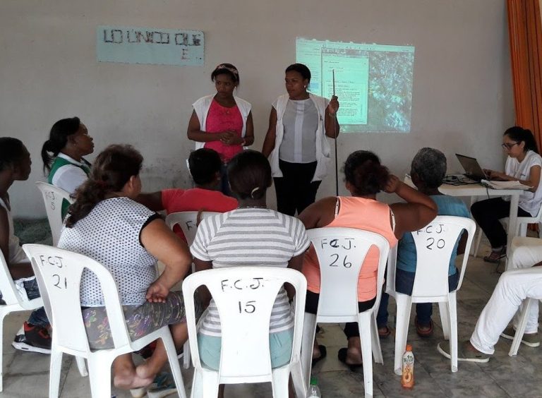
The Social Cartography Tool (SCT) is a participatory mapping activity that provides information on a specific area's territory and social dynamics by utilizing residents' unique perspectives. It aims to assist operations by geolocating community practices, access barriers, conflicts, projects, and social networks. The SCT is adaptable to any setting, promotes community engagement, and can be shared with community members for empowerment and local negotiations.
The Social Cartography Tool utilizes satellite imagery and collective territory mapping workshops, with a fully developed protocol.
Total: 3 months
©Copyright. All rights reserved.
We need your consent to load the translations
We use a third-party service to translate the website content that may collect data about your activity. Please review the details in the privacy policy and accept the service to view the translations.